Weather Alert in Ohio
Severe Thunderstorm Warning issued April 29 at 2:17PM EDT until April 29 at 3:00PM EDT by NWS Wilmington OH
AREAS AFFECTED: Clinton, OH; Delaware, OH; Fayette, OH; Franklin, OH; Greene, OH; Madison, OH; Pickaway, OH; Union, OH
DESCRIPTION: At 216 PM EDT, a severe thunderstorm was located over Choctaw Lake, moving east at 60 mph. HAZARD...60 mph wind gusts and penny size hail. SOURCE...Radar indicated. IMPACT...Expect damage to trees and power lines. Locations impacted include... Port Columbus Airport, Paintersville, East Ringgold, Interstate 71 at State Route 38, Rosemoor, Gahanna, Lumberton, Center Village, Madison Mills, Worthington, Kilbourne, Hilliard, New California, Grandview Heights, Whitehall, Orient, Amity, Ostrander, South Solon, and Delaware. This includes the following Interstates... I-70 in Ohio between mile markers 71 and 111. I-71 in Ohio between mile markers 47 and 138.
INSTRUCTION: For your protection move to an interior room on the lowest floor of a building. Continuous cloud to ground lightning is occurring with this storm. Move indoors immediately. Lightning is one of nature's leading killers. Remember, if you can hear thunder, you are close enough to be struck by lightning. To report severe weather, go to our website at weather.gov/iln and submit your report via social media, when you can do so safely.
Want more detail? Get the Complete 7 Day and Night Detailed Forecast!
Current U.S. National Radar--Current
The Current National Weather Radar is shown below with a UTC Time (subtract 5 hours from UTC to get Eastern Time).

National Weather Forecast--Current
The Current National Weather Forecast and National Weather Map are shown below.

National Weather Forecast for Tomorrow
Tomorrow National Weather Forecast and Tomorrow National Weather Map are show below.

North America Water Vapor (Moisture)
This map shows recent moisture content over North America. Bright and colored areas show high moisture (ie, clouds); brown indicates very little moisture present; black indicates no moisture.

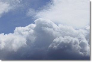
Weather Topic: What are Nimbostratus Clouds?
Home - Education - Cloud Types - Nimbostratus Clouds
 Next Topic: Precipitation
A nimbostratus cloud is similar to a stratus cloud in its formless,
smooth appearance. However, a nimbostratus cloud is darker than a stratus cloud,
because it is thicker.
Unlike a stratus cloud, a nimbostratus cloud typically brings with it the threat
of moderate to heavy precipitation. In some cases, the precipitation may evaporate
before reaching the ground, a phenomenon known as virga.
Next Topic: Precipitation
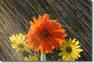
Weather Topic: What is Rain?
Home - Education - Precipitation - Rain
 Next Topic: Shelf Clouds
Precipitation in the form of water droplets is called rain.
Rain generally has a tendency to fall with less intensity over a greater period
of time, and when rainfall is more severe it is usually less sustained.
Rain is the most common form of precipitation and happens with greater frequency
depending on the season and regional influences. Cities have been shown to have
an observable effect on rainfall, due to an effect called the urban heat island.
Compared to upwind, monthly rainfall between twenty and forty miles downwind of
cities is 30% greater.
Next Topic: Shelf Clouds
Current conditions powered by WeatherAPI.com


