Weather Alert in Ohio
Severe Thunderstorm Warning issued April 29 at 2:17PM EDT until April 29 at 3:00PM EDT by NWS Wilmington OH
AREAS AFFECTED: Clinton, OH; Delaware, OH; Fayette, OH; Franklin, OH; Greene, OH; Madison, OH; Pickaway, OH; Union, OH
DESCRIPTION: At 216 PM EDT, a severe thunderstorm was located over Choctaw Lake, moving east at 60 mph. HAZARD...60 mph wind gusts and penny size hail. SOURCE...Radar indicated. IMPACT...Expect damage to trees and power lines. Locations impacted include... Port Columbus Airport, Paintersville, East Ringgold, Interstate 71 at State Route 38, Rosemoor, Gahanna, Lumberton, Center Village, Madison Mills, Worthington, Kilbourne, Hilliard, New California, Grandview Heights, Whitehall, Orient, Amity, Ostrander, South Solon, and Delaware. This includes the following Interstates... I-70 in Ohio between mile markers 71 and 111. I-71 in Ohio between mile markers 47 and 138.
INSTRUCTION: For your protection move to an interior room on the lowest floor of a building. Continuous cloud to ground lightning is occurring with this storm. Move indoors immediately. Lightning is one of nature's leading killers. Remember, if you can hear thunder, you are close enough to be struck by lightning. To report severe weather, go to our website at weather.gov/iln and submit your report via social media, when you can do so safely.
Want more detail? Get the Complete 7 Day and Night Detailed Forecast!
Current U.S. National Radar--Current
The Current National Weather Radar is shown below with a UTC Time (subtract 5 hours from UTC to get Eastern Time).

National Weather Forecast--Current
The Current National Weather Forecast and National Weather Map are shown below.

National Weather Forecast for Tomorrow
Tomorrow National Weather Forecast and Tomorrow National Weather Map are show below.

North America Water Vapor (Moisture)
This map shows recent moisture content over North America. Bright and colored areas show high moisture (ie, clouds); brown indicates very little moisture present; black indicates no moisture.

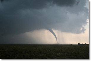
Weather Topic: What are Wall Clouds?
Home - Education - Cloud Types - Wall Clouds
 Next Topic: Altocumulus Clouds
A wall cloud forms underneath the base of a cumulonimbus cloud,
and can be a hotbed for deadly tornadoes.
Wall clouds are formed by air flowing into the cumulonimbus clouds, which can
result in the wall cloud descending from the base of the cumulonimbus cloud, or
rising fractus clouds which join to the base of the storm cloud as the wall cloud
takes shape.
Wall clouds can be very large, and in the Northern Hemisphere they generally
form at the southern edge of cumulonimbus clouds.
Next Topic: Altocumulus Clouds
Weather Topic: What are Altostratus Clouds?
Home - Education - Cloud Types - Altostratus Clouds
 Next Topic: Cirrocumulus Clouds
Altostratus clouds form at mid to high-level altitudes
(between 2 and 7 km) and are created by a warm, stable air mass which causes
water vapor
to condense as it rise through the atmosphere. Usually altostratus clouds are
featureless sheets characterized by a uniform color.
In some cases, wind punching through the cloud formation may give it a waved
appearance, called altostratus undulatus. Altostratus clouds
are commonly seen with other cloud formations accompanying them.
Next Topic: Cirrocumulus Clouds
Current conditions powered by WeatherAPI.com


