Weather Alert in Ohio
Severe Thunderstorm Warning issued April 29 at 2:47PM EDT until April 29 at 3:45PM EDT by NWS Wilmington OH
AREAS AFFECTED: Fairfield, OH; Licking, OH; Pickaway, OH
DESCRIPTION: SVRILN The National Weather Service in Wilmington has issued a * Severe Thunderstorm Warning for... Fairfield County in central Ohio... Eastern Pickaway County in central Ohio... Licking County in central Ohio... * Until 345 PM EDT. * At 247 PM EDT, a severe thunderstorm was located over Easton, moving east at 55 mph. HAZARD...60 mph wind gusts and penny size hail. SOURCE...Radar indicated. IMPACT...Expect damage to trees and power lines. * Locations impacted include... East Ringgold, US Route 22 at State Route 159, Millersport, US Route 62 at State Route 661, Purity, Johnstown, Brownsville, Utica, Clearport, Kirkersville, State Route 158 at State Route 204, North Berne, Pleasantville, Alexandria, Jersey, Marne, Gratiot, St. Louisville, Fairfield Beach, and Toboso. This includes I-70 in Ohio between mile markers 113 and 142, and near mile marker 144.
INSTRUCTION: For your protection move to an interior room on the lowest floor of a building. Large hail, damaging wind, and continuous cloud to ground lightning are occurring with this storm. Move indoors immediately. Lightning is one of nature's leading killers. Remember, if you can hear thunder, you are close enough to be struck by lightning. To report severe weather, go to our website at weather.gov/iln and submit your report via social media, when you can do so safely.
Want more detail? Get the Complete 7 Day and Night Detailed Forecast!
Current U.S. National Radar--Current
The Current National Weather Radar is shown below with a UTC Time (subtract 5 hours from UTC to get Eastern Time).

National Weather Forecast--Current
The Current National Weather Forecast and National Weather Map are shown below.

National Weather Forecast for Tomorrow
Tomorrow National Weather Forecast and Tomorrow National Weather Map are show below.

North America Water Vapor (Moisture)
This map shows recent moisture content over North America. Bright and colored areas show high moisture (ie, clouds); brown indicates very little moisture present; black indicates no moisture.

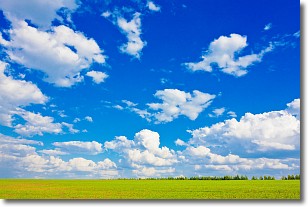
Weather Topic: What are Cumulus Clouds?
Home - Education - Cloud Types - Cumulus Clouds
 Next Topic: Drizzle
Cumulus clouds are fluffy and textured with rounded tops, and
may have flat bottoms. The border of a cumulus cloud
is clearly defined, and can have the appearance of cotton or cauliflower.
Cumulus clouds form at low altitudes (rarely above 2 km) but can grow very tall,
becoming cumulus congestus and possibly the even taller cumulonimbus clouds.
When cumulus clouds become taller, they have a greater chance of producing precipitation.
Next Topic: Drizzle
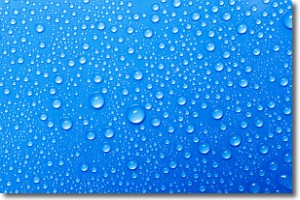
Weather Topic: What is Evaporation?
Home - Education - Precipitation - Evaporation
 Next Topic: Fog
Evaporation is the process which returns water from the earth
back to the atmosphere, and is another crucial process in the water cycle.
Evaporation is the transformation of liquid into gas, and it happens because
molecules are excited by the application of energy and turn into vapor.
In order for water to evaporate it has to be on the surface of a body of water.
Next Topic: Fog
Current conditions powered by WeatherAPI.com


